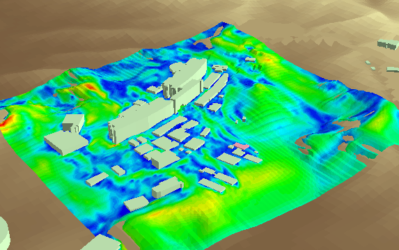
Airflow Analystは、GISと風況シミュレーションを統合的に処理するArcGIS拡張機能です。 GISデータを使って風況解析に必要な計算格子を簡単に作成し、 解析処理後には結果の風況を様々な可視化手法で3Dシーンに表示できます。
Airflow Analyst is an ArcGIS extension that integrates GIS and wind simulations.
Using GIS data, you can easily create a computational grid required for wind analysis.
After the analysis process, you can display the resulting wind conditions on the 3D scene with various visualization methods.
この文書の内容は開発中のものです。 リリース時には変更となる場合があります。
The contents in this document are under development. It may be changed at the time of release.