
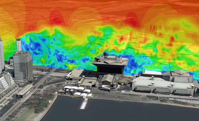
The flow of wind greatly influences our living environment. The improvement of urban climates, the use of new energy, and risk management for fire or gas leaks are just a few of the many issues that are deeply intertwined with the movement of the wind. The advancement of computer technology in recent years has made it easier to analyze the invisible flow of wind through simulation and visualization techniques. These have been utilized as alternatives to wind tunnel experiments.
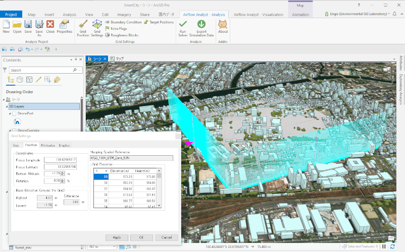
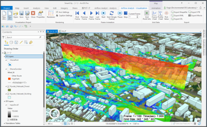
Airflow Analyst® is a software that simulates complex wind flows using Geographic Information System (GIS) and spatial data. Analysts can specify the area they want to analyze on the map and accurately recreate and understand the wind flow around the terrain and buildings in that area. This tool enables us to visually explore various wind environments and use them to solve real-world problems.
>Main Features
System Requirement
| Item | Operating Requirements |
| Operating System | Windows 11 Home, Pro, Enterprise (64-bit) Windows 10 Home, Pro, Enterprise (64-bit) |
| CPU | Intel Core i-5,7,9 series recommended |
| Memory /RAM | Recommend: 32 GB or more |
| GPU | GPU memory 4GB or more Recommended: OpenGL 4.5 (ARB_shader_draw_parameters, EXT_swap_control, EXT_texture_compression_s3tc, EXT_texture_filter_anisotropic extensions) |
| GIS Software | ArcGIS Pro 3.0 or above |
Airflow Analyst Trial Download
Trial period: about 1 month
Difference between the trial version and the full version:
There is a limit to the number of grids that can be calculated.
Operating conditions:
・ArcGIS Pro 3.0 or higher
・OpenGL graphics board
・12GB memory or more recommended